I first came upon this map years ago, when visiting Moritz Kissinger.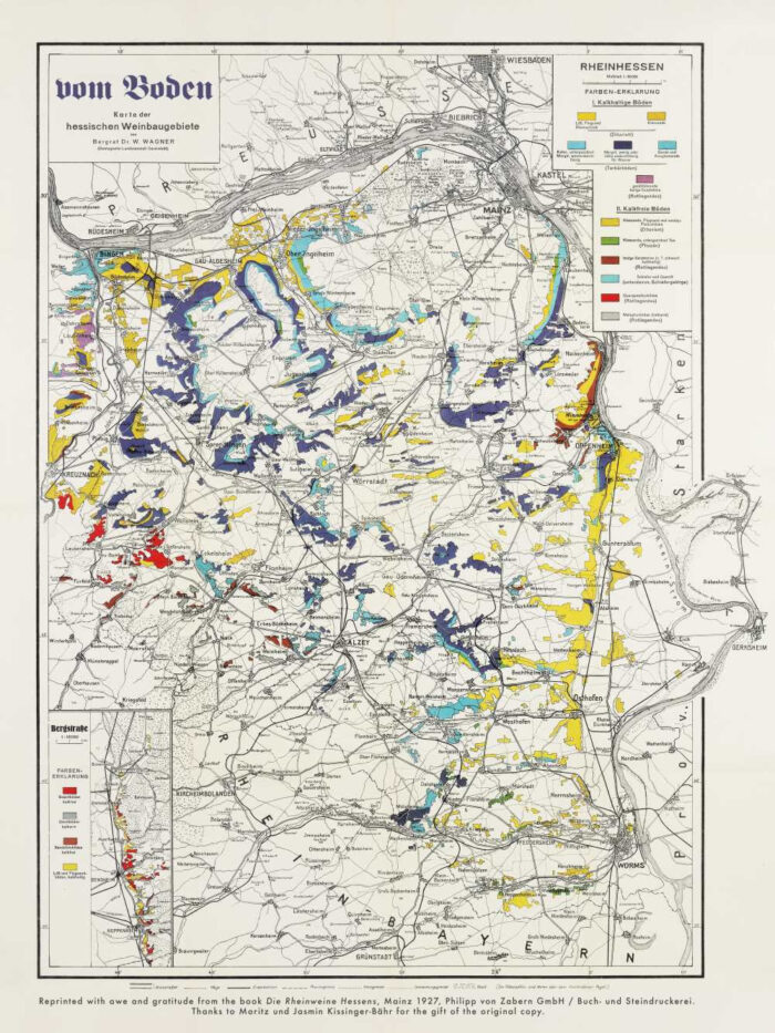
Moritz had the book, Die Rheinweine Hessens, on a small table in one of the rooms at the estate and it caught my eye.
In the back of the book, as was not uncommon in earlier publishing, there was a specially designed pocket to hold a larger, folding map. This was, logically enough, a map of the Rheinhessen. It was first printed in the early 20th century with a very detailed analyses of the various soils of the Rheinhessen, from the Roter Hang to Keller’s Wonnegau. I’m told some earlier versions of this map were actually commissioned to help the authorities react and respond to phylloxera, which migrated slower into the colder, northern vineyards of Europe.
Regardless, we were all – myself, Moritz, and his wife Jasmin – really taken by the map and every time I’d visit I’d pull out the map to look at it. Eventually they had it framed, which made my map-envy only grow.
Last summer they found another copy of the book, complete with an intact map, and gave it to me as a gift. They also tried to reach out to the publisher (no longer in business) to request permission to reprint this amazing map.
And so that is what we are doing.
This map is just too beautiful, and too important, not to make available.
What we are offering today, so far as I’m aware, is the first and only reprinting of this map – certainly in the U.S. We are going to take orders and print what we need to cover all the requests. So please note these maps will not ship until later in April or even early May.
Die Rheinweine Hessens Map Reprint – $35
Map measures 18 x 24 inches; purchase price covers shipping within the continental U.S.
No shipping to Europe, ironically. Sorry.